Sixth-grader Alton Barnes loves maps, and when his portfolio of secret maps is stolen, he begins getting notes with orders that he must obey to get the maps back but, with the help of a popular classmate, he just might succeed before his teacher, principal, or someone else learns he has been studying and mapping things about them.
Provides an exploration of Australia, Oceania, and Antarctica, discussing their climates, wildlife, natural landmarks, industries, sports and more, using maps.
Maps, photographs, illustrations, and text present information about the continents of the world. Understanding your world -- North America -- South America -- Europe -- Asia -- Africa -- Australia -- Antarctica.
Provides an introduction to maps explaining scale; using a compass; longitude and latitude; measuring elevation, depth, and astronomical units ; and related math concepts.
Presents a biography on the life of sixteenth-century cartographer, Gerard Mercator, who drew the entire curved earth on a flat surface allowing for more accurate navigation by sailors and scientists.
Examines the geology and natural history of the highest regions of California's Sierra Nevada range, and looks at the records of early explorations of the peaks. Includes maps, photographs, and geologic guides.
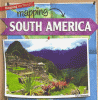
Readers will learn many fascinating facts about the geography of South America. Colorful photographs and detailed maps introduce them to a continent full of high mountains, bustling cities, and fertile grasslands.