maps

Type: 
Geographic Name
Subfield: 
v
Alias: 
maps

Asia

1998
Text, photographs, and maps introduce information about the climate, regions, people, cultures, animals, plants, resources, politics, and religions of Asia.

Africa

1999
Text and maps introduce information about the climate, regions, people, cultures, animals, plants, resources, politics, and religions of Africa.

Atlas of the Civil War

2004
Presents a comprehensive atlas of the Civil War and contains over two hundred full-color maps, archival photographs and black-and-white illustrations, and narratives by two well-known Civil War scholars.

Atlas of the Greek world

1988
Text, illustrations, and maps describe the cultural background of Greece, geography, history, and Greek society.

Australia and the South Pacific

1999
Text, photographs, and maps introduce information about the climate, land use, resources, plants and animals, population, politics, and religions of Australia, New Zealand, and the islands of the South Pacific.

Historical atlas of the Crusades

2002
Presents an historical atlas of the Crusades, covering such topics as the conflicts between Roman and Orthodox Christian churches, Arab conquests, and the attempts to reclaim the Holy Land, and contains detailed maps, photographs, and illustrations.

Historical atlas of Ancient America

2001
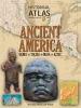
Presents an historical atlas of Ancient America containing detailed maps, photographs, and illustrations on the civilizations of over three thousand years of Mesoamerican society, commerce, political, and social development, and describes the Toltecs, Zapotecs, Mixtee, Mayans, and Aztecs.

National Geographic United States atlas for young explorers

1999
Maps, photographs, illustrations, and text present information about the regions and states of the United States.

National Geographic United States atlas for young explorers

2004
Maps, photographs, illustrations, and text present information about the regions and states of the United States.

Pages

Subscribe to RSS - maps