Text, photographs, and maps introduce information about the climate, land use, resources, plants and animals, population, politics, and religions of North America.
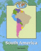
Text, photographs, and maps introduce information about the climate, land use, resources, plants and animals, population, politics, and religions of South America.
Explains how to measure distance on maps through use of scale bars, color keys, and contour lines; includes suggested activities to illustrate the concepts.