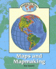
Text, photographs, and maps introduce information about the climate, land use, resources, plants and animals, population, politics, and religions of North America.
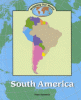
Text, photographs, and maps introduce information about the climate, land use, resources, plants and animals, population, politics, and religions of South America.
Presents an illustrated history of cartography and discusses how early maps reflected their makers' worldviews and the beliefs of the period. Includes illustrations of rare mapping artifacts, informative essays, and eighty-seven color reproductions of maps.
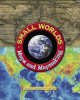
Describes the lives and inspirations of several important mapmakers throughout history, such as Cheng Ho, Captain James Cook, and Phyllis Pearsall, and includes map reproductions.
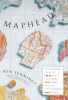
Ken Jennings shares his enthusiasm of maps and discusses a number of related topics, such as map making and collecting, the National Geographic Bee, and Google Earth.